Navigating without GPS: a quantum gravimeter goes to sea
A vessel crossed 83 kilometres of the Coral Sea with its satellite receiver switched off, holding its position to about a nautical mile by reading the Earth's gravity field. The claim comes from the company that built the instrument, and the interesting part is what it does not solve.
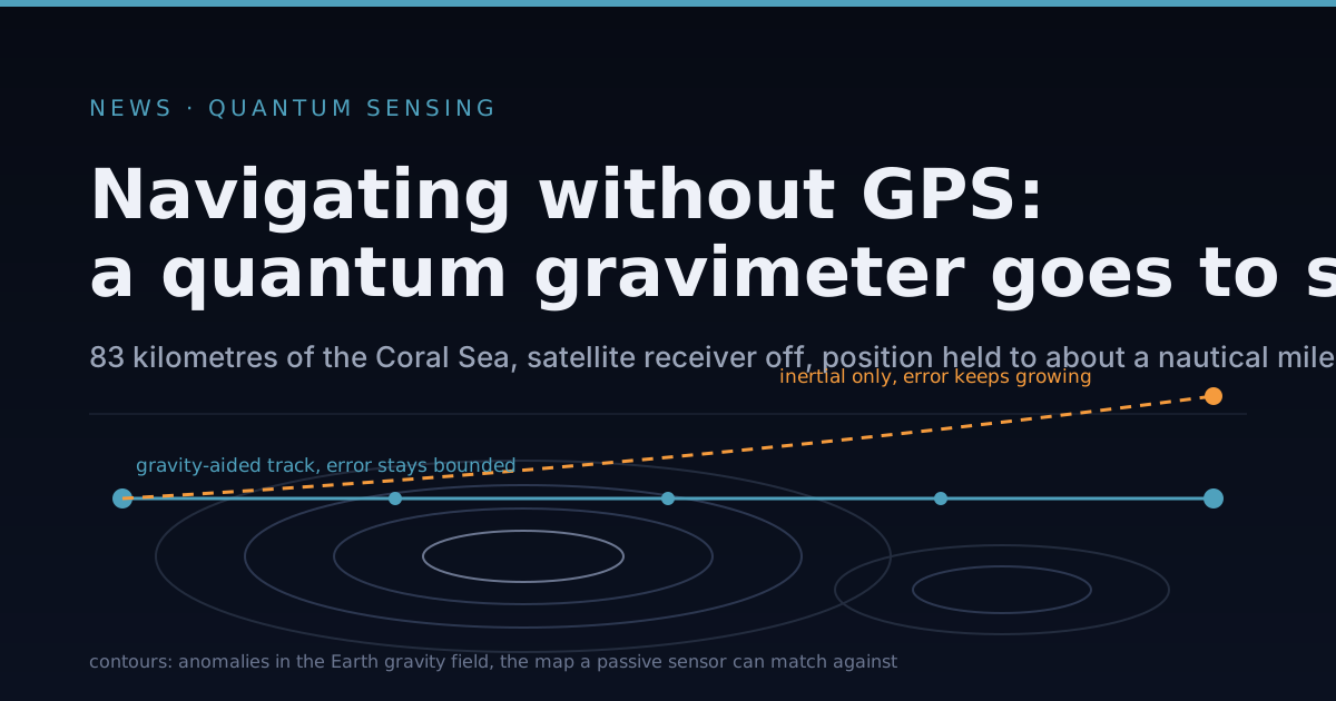
On 27 August the Australian company Q-CTRL said it had taken a 29 metre vessel across 83 kilometres of the Coral Sea with its satellite navigation receiver switched off, and held its position to within about one nautical mile for the whole run. The instrument doing the work was a quantum gravimeter: a device that measures the local strength of gravity by dropping a cloud of laser-cooled atoms and watching them fall. Against a navigation-grade inertial system running on the same track, the company reports better than a tenfold improvement in position error.
Two words in that paragraph carry the result. The first is bounded. The second is passive.
Why a ship without satellites gets lost
An inertial navigation system is a box of accelerometers and gyroscopes that measures how the vehicle is being pushed and turned, then integrates those measurements to work out where the vehicle has got to. It needs no outside signal, which is its virtue, and it has one structural flaw. Integration accumulates. A small constant error in measured acceleration becomes a velocity error that grows in proportion to time, and a position error that grows with the square of it. Marine inertial systems are specified in nautical miles of drift per day for exactly this reason: the error has no ceiling, it only has a rate.
In normal operation nobody cares, because a satellite fix arrives every second and resets the accumulation to nearly zero. Remove the satellites and there is nothing to reset against. That is no longer a hypothetical. Lloyd’s List Intelligence logged more than 1,700 interference events affecting hundreds of vessels in the opening weeks of this year’s conflict, and more than 1,100 ships reported losing their signal in the Strait of Hormuz inside a single day. Jamming drowns the satellite signal in noise. Spoofing is worse: a false signal that the receiver accepts, so the ship is confidently somewhere it is not.
The classical answer is map matching. Aircraft have used terrain contour matching for decades, comparing measured ground clearance against a stored elevation map. Submarines use magnetic anomaly maps. Gravity is the third option, and at sea it is the best of the three, because the ocean has no terrain to see and its magnetic surveys are patchy.
Reading the shape of the field
Gravity is not the same everywhere. A seamount is a pile of dense rock, and it pulls slightly harder than the water it displaced; a trench pulls slightly less. Variations in the density of the crust below add their own texture. The differences are small, on the order of tens of parts per million of the local acceleration, but they are fixed in place and they form a pattern. Measure the local value accurately enough, slide it against a stored map of those anomalies, and the best fit is a position fix.
Nothing is transmitted and nothing is received. There is no signal for anyone to jam, and no signal to spoof unless the adversary can alter the density of the seafloor.
The catch has always been the instrument. A conventional gravimeter is a proof mass on a spring, and it measures relative change rather than an absolute value: its zero point wanders with temperature and with age, so it must be recalibrated against a known reference. That is fine on a survey pier and useless on a ship that has been at sea for a week.
An atom interferometer works differently. A cloud of atoms is cooled with lasers to a few millionths of a degree above absolute zero, then released into free fall. A pulse of light splits each atom into a superposition of two paths, one nudged by the photon momentum and one not, so the two versions of the same atom fall along slightly different trajectories. A second pulse turns them back toward each other, a third recombines them, and the interference between the two paths shows up as a fringe whose phase depends on how hard gravity pulled during the flight. The reference is the wavelength of the laser and an atomic transition frequency, both of which are constants of nature rather than properties of a manufactured part. So the measurement is absolute, and it does not drift.
The part of the announcement that is genuinely new is not the physics, which dates to the 1990s, but the setting. These instruments normally live on vibration-isolated slabs, because a ship rolling in a swell subjects the falling atoms to accelerations thousands of times larger than the anomaly being measured. Q-CTRL reports that its software stripped the sea motion out well enough that a strapdown mounting, bolted rigidly to the hull, performed comparably to a gimballed one on a stabilised platform. If that holds up, it removes a large, heavy and expensive subsystem.
What the trial does not show
A company announcement about a company product is a claim, not a finding. The supporting detail sits in a preprint posted to arXiv, which has not been through peer review. It is one vessel, one sea, one run.
One nautical mile is also not a substitute for satellite navigation. GPS delivers metres. A bounded kilometre-scale fix is the right answer for a warship that needs to keep fighting through a jamming campaign, and the wrong answer for a container ship entering a harbour. The technology competes with the drift of an inertial system, not with the accuracy of a constellation.
The sharpest limitation is the map. The preprint reports the sensor resolving gravity structure down to roughly 300 metres along track, some fifty times finer than the half-power wavelength of the satellite-derived global gravity fields that map matching normally leans on. The instrument now out-resolves the reference. Matching can only be as good as the map, and over an abyssal plain the map is close to featureless: no contrast, no fix, and the inertial drift resumes until something interesting passes underneath. This is why the preprint’s title pairs navigation with marine surveying. In the near term the more useful product may be the map itself.
Then there is the physical envelope. Cold atom instruments are cabinets, with lasers, vacuum chambers and magnetic shielding. They fit a naval vessel or a submarine. They do not fit an aircraft cheaply, a drone at all, or anything smaller. And “navigation-grade” inertial system covers a wide range of hardware and prices, so a tenfold comparison means less until the baseline is specified.
Further reading
- Q-CTRL’s account of the field trial, the company’s own announcement and figures
- The preprint: GNSS-free quantum gravity-aided navigation and fine-scale marine surveying, with the trajectory and error analysis
- Cold atom inertial sensors for navigation applications, a review of why atom interferometers do not drift
- Gravity surveys using a mobile atom interferometer, an earlier demonstration of the same physics on the move